The Best Bicycle Routes on Carson Pass
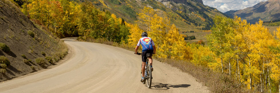
Cyclers have miles of road from which to choose on Carson Pass. Undoubtedly the most spectacular are routes that lead up to the summit of Carson Pass, whether from east or west sides. Bicycle riders will want to be sure to tuck a camera in among their gear. Traffic on Highway 88 can be heavy on summer weekends, but early in the morning or on midweek days the flow is usually sparse.
Other popular rides are through beautiful Hope Valley and out the Blue Lakes Road.
Several great cycling races include Carson Pass as part of their itinerary. The Alta Alpina Challenge: Riding the Wild Sierra, usually held in late June, offers a variety of rides which take in Blue Lakes and the east side of Carson Pass. The famous Tour of California Alps Death Ride, held in mid-July, no longer includes Carson Pass on its race route, but for cycling enthusiasts, driving over to Markleeville can put you at the starting line.
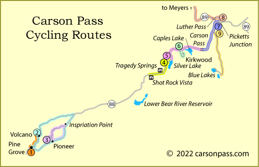
1. Pine Grove to Volcano
Mileage and Difficulty: 3.5 miles one way, easy
Elevation changes: Pine Grove to Volcano: ascend 585', descend 1040'
Route type: out and back, asphalt
Take the gentle ride from Pine Grove to Volcano, perhaps stopping in at Indian Grinding Rock State Park along the way. From Pine Grove the road drops to Grass Valley Creek and then climbs very gently to a summit before descending to Volcano.
The return trip begins with a stiff half-mile climb, gaining nearly 500 feet.
2. Volcano Loop
Mileage and Difficulty: 26-mile loop, difficult
Elevation changes: climb from 2,050' to 4,250'
Route type: loop, asphalt
Begin in Volcano and ride up Rams Horn Grade until it connects with Shake Ridge Road at mile 3. Turn right (north) onto Shake Ridge and follow it in a northeasterly direction past Fiddletown Road and on up to Highway 88 at mile 13.
Turn downhill on Highway 88, coasting along it all the way through Pioneer to Volcano-Pioneer Road at mile 23. Turn right onto that road and continue along it back to Volcano.
3. Pioneer Loop
Mileage and Difficulty: 11.5-mile loop, moderate
Elevation changes: 2,900' to 3,650'
Route type: loop, asphalt
The scenic loop carries you through the back country near Pioneer and up to Inspiration Point on Highway 88 before returning down the highway to Pioneer. From Pioneer head up Pioneer Creek Road to Sugar Pine Drive. Head east on Sugar Pine Drive until it intersects Highway 88.
A short distance up the highway is Inspiration Point. Turn around there at Inspiration Point and head down it past Buckhorn Lodge and on to Pioneer.
4. Silver Lake to Shot Rock Vista Picnic Area
Mileage and Difficulty: 6.5 miles one way, moderate
Elevation changes: 7,300' to 7,950' to 7,600'
Route type: out and back, asphalt
Outstanding views of Silver Lake and the mountains beyond reward those who take this ride from Silver Lake west on the highway past two vista points and several historic locations. Begin at Silver Lake and climb steadily for nearly 3 miles before beginning a gradual downhill. Swing off the highway at Tragedy Spring where you'll find a historic marker, an emigrant grave, and picnic area. The marker commemorates the deaths of 3 early explorers on the emigrant route in 1848. Continue on the side road until it rejoins the highway.
At mile 4.5 you arrive at Devil's Garden Vista Point and Maiden's Grave. An historic marker there tells of the sad death of young Rechall Melton in 1850. From there continue downhill to Shot Rock Vista Point Picnic Area. There you will find 3 picnic tables and a vault toilet.
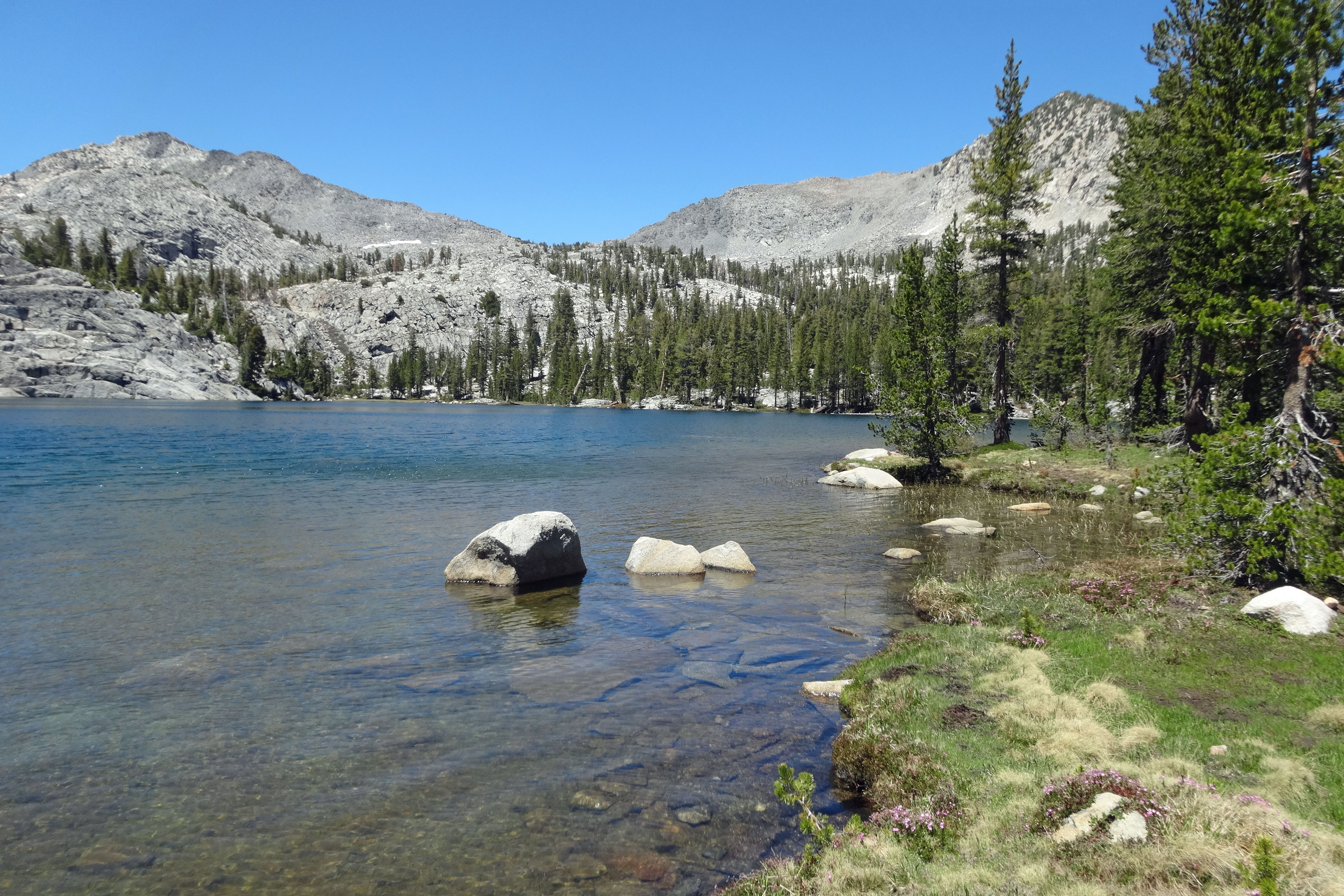
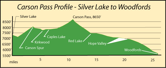
5. Silver Lake to Carson Pass
Mileage and Difficulty: 11 miles one way, difficult
Elevation changes: 7,300' to 8,600'
Route type: out and back, asphalt
This alpine ride takes you past some of the most spectacular scenery on Carson Pass. Begin at Silver Lake and climb immediately 900 feet to the Silver Spur. From there enjoy a gentle descent into Kirkwood and a nearly level road around the northern shore of Caples Lake.
Then a steady climb with panoramic vistas over the next 4 miles delivers you to the summit of Carson Pass where you will find a small parking area and restrooms. There are several stopping places along the way, including the Kirkwood Inn and Caples Lake Resort.
Ambitious cyclists may choose to descend another 15 miles to Woodfords, turn around and retrace the route to Silver Lake.
6. Tour of Kirkwood
Mileage and Difficulty: 5 miles round trip, easy
Elevation changes: 7,700' to 7,900'
Route type: semi-loop, asphalt
This relaxed tour of the Kirkwood Ski Area begins at Highway 88 and Kirkwood Meadows Road. Follow the road up the valley, gaining only 200 feet to the parking lot near the ski lifts. Then circle down the east side of the valley, making a loop before retracing your steps.
During the summer Kirkwood offers its lifts for use by mountain bikers during July and August. The general store is open in the summer.
7. Picketts Junction to Carson Pass
Mileage and Difficulty: 9 miles one way, difficult
Elevation changes: 7,100' to 8,600'
Route type: Out and back, asphalt
The ride climbs from Picketts Junction (highways 88 and 89) in the Hope Valley up Carson Pass on a moderately heavily used highway. Begin with an easy, mostly level 3-mile warm-up across Hope Valley and then a gradual climb toward Red Lake. The last 3 miles are steep, gaining 1000 feet in elevation. A Vista Point at mile 7.5 provides a great view back over the valley and out toward surrounding mountains.
At the summit you will find a small parking area, restrooms, and more great views. This section of the pass is part of the famous Tour of California Alps Death Ride held every summer. For more about the Death Ride, see Death Ride.
8. Picketts Junction to Meyers (via Luther Pass)
Mileage and Difficulty: 11.5 miles one way, difficult
Elevation changes: 7,100' to 7,800' to 6,300'
Route type: Out and back, asphalt
Begin in Hope Valley at Picketts Junction and climb 700 feet in 3 miles to Luther Pass. Pedal along the side of Grass Lake and then begin a long, 1,500' descent to Meyers in the Lake Tahoe Basin. Stop at the Big Meadow trailhead for a break along the way if you want.
The final three miles into Meyers are fairly level. It's another 5 miles along congested Highway 50 to the Y in South Lake Tahoe.
9. Hope Valley to Blue Lakes
Mileage and Difficulty: 12 miles one way, difficult
Elevation changes: 7,100' to 8,200' to 8,050'
Route type: Out and back, asphalt
Begin in Hope Valley where the Blue Lakes Road departs from Highway 88. Cycle through Hope, Faith, and Charity valleys, gaining 700' in the first 7.5 miles. Then begin a steeper climb up to Border Ruffian Pass before a descent to Blue Lakes.
You'll find restrooms and water at the Lower Blue Lake Campground just a short distance up the shore of the lake. From Lower Blue Lake various roads lead off in different directions. Most are dirt or gravel.