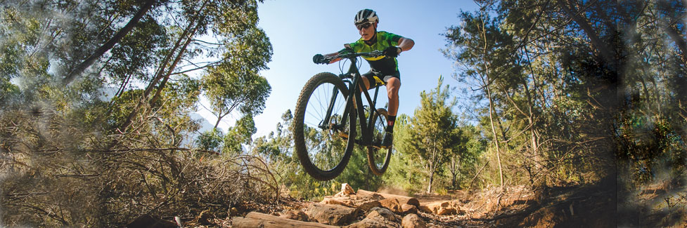
Carson Pass Mountain Biking
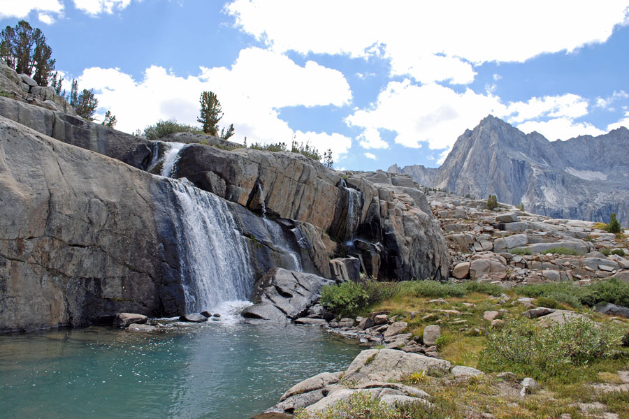
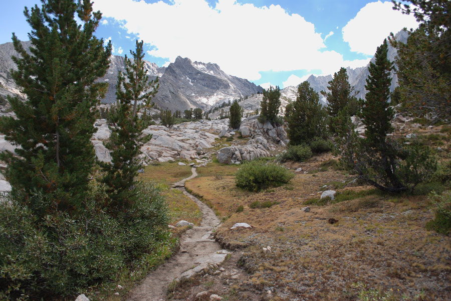
A number of good mountain bike routes are found on both sides of Carson Pass. Some of the best are around Silver and Caples lakes where trails and roads lead up to ridges and summits with spectacular views of the surrounding area. The Eldorado National Forest has a list of routes that are open to bicycles which may be helpful in planning rides: Non-motorized Trails. We show some of the best here.
Staying on Track: The woods are crisscrossed with trails and roads. Avoid getting lost. Carry one or two good maps (Forest Service and USGS), a GPS, compass, and cell phone. It may sound like overkill. But it's too easy to get off on a wrong trail and find yourself hopelessly lost, miles from your destination.
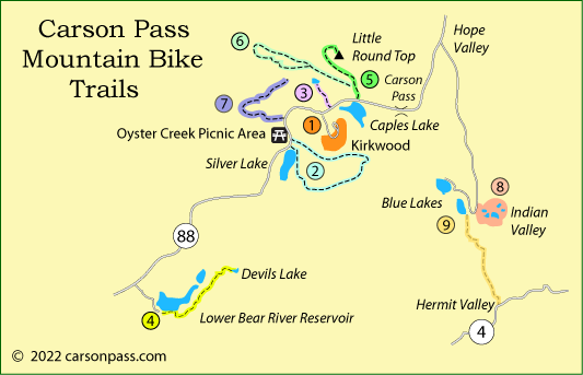
1. Kirkwood Mountain Biking
On summer weekends Kirkwood Ski Resort opens miles of alpine trails, along with chairlifts 1 and 2, to mountain bikers. There are routes appropriate for beginners through advanced riders.
Hours of Operation: 9:30am - 4:30 pm, Saturday and Sunday (July/August including Labor Day weekend)
2. Silver Lake - Hungalelti Ridge (formerly Squaw Ridge) Loop
Mileage: 16 mile loop, difficult
Elevation changes: 7,200' to 9,200'
Route type: 4-wheel route and single track
This challenging 16 mile loop takes you from Silver Lake up onto spectacular Hungalelti Ridge overlooking the whole area and then down a 5.2-mile plunge back to your starting point. Be sure to carry water.
Park at Oyster Creek Picnic Area off Highway 88 just east of Silver Lake. Ride back down the highway to Silver Lake and turn at Kit Carson Resort, following the road past the resort. Road soon turns to trail, leading to Granite Lake where you'll find lots of places to bounce around on the rocks. Then continue past Hidden Lake and up the ridge to join a jeep trail that will lead up Hungalelti Ridge.
Press on up the ridge to 9,200' after 11 miles since leaving your car. The actual Horse Canyon is on your right, but the trail to your left is known as the Horse Canyon Trail. Turn left down that trail which leads almost straight down the mountainside to Highway 88, almost exactly at Oyster Creek Picnic Area.
3. Lake Margaret
Mileage and Difficulty: 5 miles round trip, easy
Elevation changes: 7,700' to 7,500'
Route type: trail
For an easy ride pick up the Lake Margaret trail on the north side of Highway 88 midway between Kirkwood and Caples Lake. The trail fluctuates a couple hundred feet throughout the length of the ride, but generally dropping slightly to the lake. Wildflowers in the spring, colorful aspens in the fall.
4. Devils Lake
Mileage and Difficulty: 12 miles round trip, moderate
Elevation changes: 5,900' to 7,300'
Route type: dirt road and trail
Start at South Shore Campground at Lower Bear River Reservoir. Ride east from the campground on roads that pass the group campground and lead out to Deer Valley. There turn left onto a 4-wheel road headed for Devil's Lake. At another junction just a short distance up the road, stay left again.
Roads turn to trail for the last 1.5 miles to the lake. Virtually the entire return ride is downhill.
Summit of Little Round Top
Mileage and Difficulty: 12 miles round trip, moderate
Elevation changes: 8,000' to 9,500'
Route type: out and back, dirt road and trail
From Caples Lake ride to the summit of Little Round Top where you will have panoramic views of the Meiss Country to east and Caples Lake to the south. Begin at the turnoff to the Cal Trans Maintenance Station at Caples Lake, or shorten the trip by driving two miles to Schneider's Cow Camp.
From the Cow Camp ride on a 4-wheel road for half a mile to pick up the trail on your right. A steep uphill mile carries you to the shoulder of Little Round Top. Follow the trail around to the north end to a point just short of the Pacific Crest Trail (bicycles are not allowed on the PCT). Turn south up the ridge to the top of the mountain.
6. Strawberry Creek Loop
Mileage and Difficulty: 14-mile loop, difficult
Elevation changes: 8,600' to 6,200' to 8,600'
Route type: loop, 4-wheel and trail
Ride north on this 14 mile loop into Strawberry Creek Canyon. The route involves fording Strawberry creek, which could be difficult in early summer. If the crossing looks too challenging, skip it and retrace your route.
Begin your ride at the parking area near Schneider Camp on the road from the Cal Trans Maintenance Station at Caples Lake. Ride west one mile and turn to the right, beginning on long downhill to Strawberry Creek. As you near the creek at about mile 7, begin to look for places to cross the creek. There is a trail heading up the east side for a short distance. It eventually crosses the creek. Eventually you need to end up on the other side.
Follow Strawberry Creek upstream on its west bank, climbing gradually. The trail becomes steeper at the head of the canyon. Stay left at a trail junction. From there the trail follows the ridge above Lake Margaret and past a radio tower. Soon after the tower you rejoin your original trail and coast back to your starting point.
7. Government Meadow and Strawberry Creek Overlook
Mileage and Difficulty: 16 miles round trip, difficult
Elevation changes: 7,600' to 6,000' to 8300'
Route type: Out and back, trail
Make an easy 4-mile ride down to Government Meadow or extend your ride by climbing 2,300' to an overlook above Strawberry Creek canyon. It's all beautiful country.
Start at Martin Meadow on Highway 88 between Silver Lake and Kirkwood. Ride down a gentle slope for 1.5 miles and then begin a steep descent toward Caples Creek. Stay to the right at a trail junction. Fording Caples Creek in early summer may be difficult, so this ride is best done later in the year.
After crossing the creek at Jake Schneider Meadow, turn right to Government Center. If you are feeling strong, stay left at the trail junction and begin a long, 4-mile climb. Along the way ignore side trails leading off the ridge. Your goal is a summit (8297') straight ahead (east-northeast). Return by the same route.
8. Indian Valley
Mileage and Difficulty: mileage varies, easy terrain
Elevation changes: 7,900' - 8,100'
Route type: dirt roads
Indian Valley is near Blue Lakes on the east side of Carson Pass. The area is virtually flat, dotted with lakes, and crisscrossed by dirt roads and trails. It's a nice area to set out into without any predetermined destination and just let your whims guide you. The only two things to avoid are the Pacific Crest Trail and the adjacent Mokelumne Wilderness to the north.
Start at a trailhead 1 mile northeast of Lower Blue Lake. Following dirt roads, head south toward Tamarack Lake, and then on down to Lily Pad Lake. Continuing on the roads you will find Sunset Lakes and Wet Meadow Reservoir.
9. Blue Lakes to Hermit Valley
Mileage and Difficulty: 13 miles round trip, moderate
Elevation changes: 8,050' to 7,100'
Route type: 4-wheel road
The route from Blue Lakes down to Hermit Valley on Highway 4 (Ebbetts Pass) is part of the old Big Trees Emigrant Trail. In more recent years it has become popular as a 4-wheel route, although the last mile into Hermit Valley deters some drivers.
Start at Lower Blue Lake and ride south down Blue Creek through Clover Valley. The route drops during the first 2.5 miles to Deer Valley and then climbs 300 feet before leveling off for a couple of miles. The last mile down to Hermit Valley is a fairly steep descent. Be prepared for a hard ride back to Blue Lakes.
Other Sierra Passes - Other Mountain Biking Adventures
Ebbetts Pass
Nearby Ebbetts Pass Scenic Byway (Highway 4) has many good mountain biking routes, especially around Lake Alpine and Spicer Meadow Reservoir. At lower elevations the Arnold Rim Trail is a great place to ride. Read about all the mountain biking available at Ebbetts Pass Adventures.
Echo Summit
North of Carson Pass on Echo Summit (Highway 50) are even more mountain biking trails, ranging from high along the Sierra crest to all over the Crystal Basin. Maps and descriptions are found on Discover Echo Summit.
Sonora Pass
For great mountain biking, take a look to the south around Sonora Pass (Highway 108). Popular trails run along abandoned narrow gauge railroad routes and in the high country near Pinecrest Lake. There are full details on Sonora Pass Vacations.